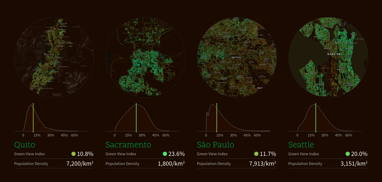
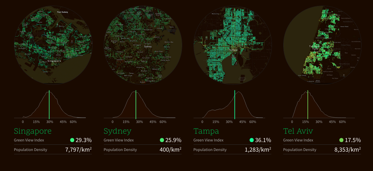
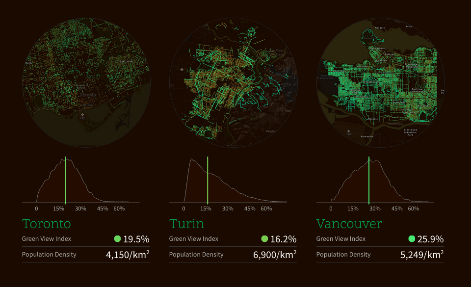
Researchers from the Massachusetts Institute of Technology (MIT) have mapped the location of trees in 26 cities around the world to create “Treepedia”.
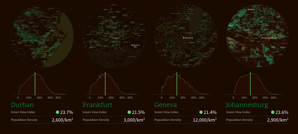
MIT’s Senseable City Laboratory developed a scalable model using Google Street View to determine the quantity of trees in urban areas. As Google does not photograph parks, Treepedia only collected data on canopy cover over streets, which it rates from 0-100 on MIT’s Green View Index.
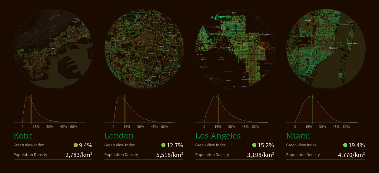
Anyone logging on Treepedia can compare cities such From Singapore to Oslo. Of the cities measured, Tampa, Florida, has the highest coverage at 36% and Paris had the lowest, with 8.8%.
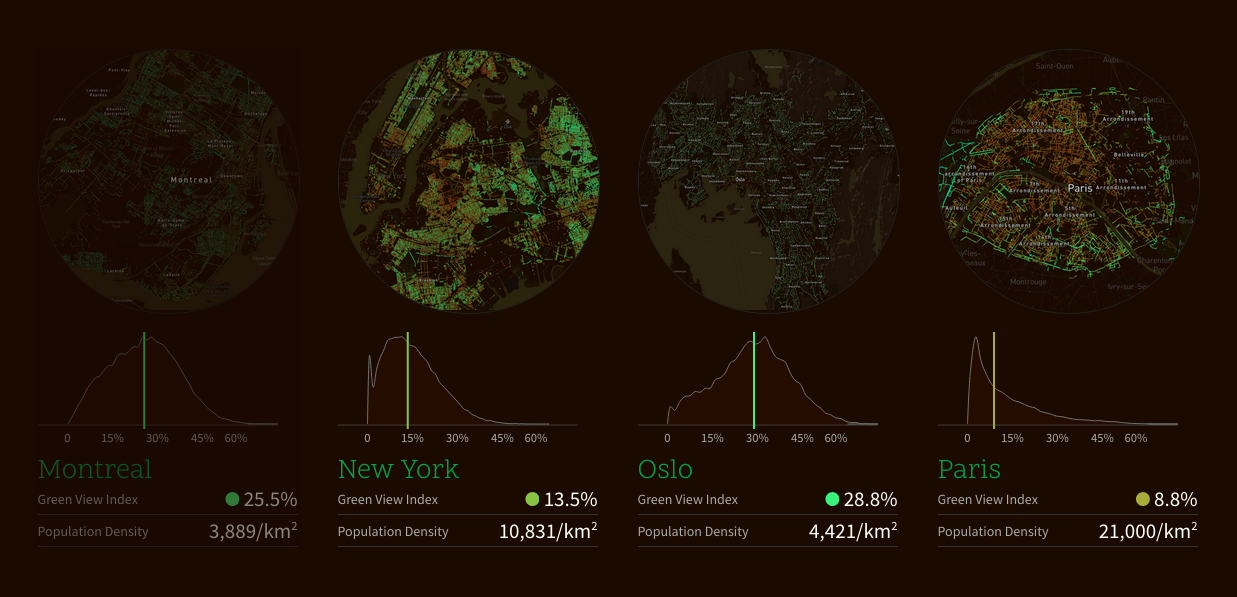
Carlo Ratti, the director of the laboratory, said: “We present here an index by which to compare cities against one another, encouraging local authorities and communities to take action to protect and promote the green canopy cover.”
MIT say that the in the 2015 World Economic Forum’s Global Agenda Council listed green canopies as one of the top 10 urban initiatives: “Cities will always need large-infrastructure projects, but sometimes small-scale infrastructure-from cycle lanes and bike sharing to the planting of trees for climate change adaptation-can also have a big impact on an urban area.”
More information is available here.
Images courtesy of MIT